Our Process
1. The first thing we require is a down payment of $100, or a payment in full if you know what package you want to purchase from our Products page.
2. We will need to get information from you as to where your property is located and the specific boundary of the property. Then we can look for the most recent/highest resolution satellite images we can find of your property. If you have custom features you want included, we will need to get that information as well. We have several ways for you to provide us with those details, which we have listed in the section below, title "Let's Get Started! What We Need From You...)
3. We will then create and email you a Draft Map to look over and approve, or make an corrections to.
4. Once you approve the Draft Map we will send you a link to pay any remaining balance you may have for your order.
5. We will print, laminate and ship your map to you right away!
6. You then open your shipping tube, fall in love with your new map and tell all yours friends about us. :)
If you have any questions, call us: 713-302-2028
Let's Get Started! What We Need From You...
We will need one of the following to begin designing your map(s):
1. A google earth file (.kmz), showing the boundary of your ranch, and any custom features you want added to your map (blinds, stands, feeders, food plots, etc.). By providing us with a google earth (.kmz) file, we can expedite your order, knowing that everything you've submitted is exactly where you want it to be on the map we create for you. This is definitely our preferred method! Review our Google Earth Tutorial Video below to see how to create a .kmz file
2. An image of your property that you submit - it can be a screenshot, or a picture of printed out map with a hand drawn boundary.
3. A set of coordinates from a survey or other such documents (with GPS coordinates of the boundary lines of your property).
4. Some counties have property boundaries marked on their CAD websites.
5. Some customers prefer us to actually print out a map and mail it to them, so they can physically draw the boundary or other custom features on it, and send it back to us. We do this often and it works well. There may be an additional printing charge if you choose this option, depending on how large of a print you need.
For more information or to ask any questions, email George Blitch at [email protected] or call him at 713-302-2028.
Google Earth Video Tutorial
This instructional video shows you how to create a file that will feature all of the data we need to start making a map of their ranch. This can include just a simply boundary outline, or more detailed items, such as the location of deer blinds, feeders, food plots, etc. To begin this process, you will simply download google earth on your computer. Once you have the latest version downloaded, locate your property on the screen, and watch the video below to start the process of creating a (.kmz) file that you will email to us, upon completion. Once we have that file, we can import it into our mapping software, to begin the process of generating a draft map for you to view and approve. *Remember, we don't use the satellite images that Google Earth uses - we have higher resolution imagery available - this is just how we create a template for your property.
Hope this tutorial is easy to understand! If you have any questions along the way, feel free to contact us. Thanks for your business!
Hope this tutorial is easy to understand! If you have any questions along the way, feel free to contact us. Thanks for your business!
Meet the Owners
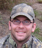
George Blitch

George had the good fortune of spending a lot of quality time at various ranches in his youth. He was raised learning how to hunt, to pay respect to the land, and to always pay attention to everything around him. When he was a boy, he would draw maps of the ranches on paper, marking the deer blinds, the water tanks, roadways (or "senderos," as he knew them), etc. When he got more involved in the multimedia world, George began working on merging the two. That passion is still alive today, as George teamed up with his longtime friend, Colin Williams, to develop a company that could combine their desire to explore nature, practice wildlife management, and to capture it all through various forms of media and maps!
Over the last 20 years, George has worked in the multimedia field, wearing many different hats. He spent a great deal of time as a professional videographer in a variety of arenas: Wildlife, Sports, TV, Short Films, etc. George is also an accomplished writer and runs a very successful publishing company (HYT Publishing) that features books that are written by, and about, Native American Indians and Indigenous Elders, worldwide. HYT Publishing is actually celebrating its 13th year in business. George is also a Financial Advisor and works with Municipal Utility Districts throughout Texas.
George is also a copywriter, graphic design, and editor. He has recently been hired by a few companies to test hunting related products. Look for his reviews on our BLOG PAGE and our email newsletters. George is very involved as a Wildlife Manager on two ranches in Texas. He is also an accomplished Hunting Guide, providing hunts for wildlife in Texas: whitetail deer, turkey, quail, dove, hogs, and coyotes. George lives in Houston, TX and is happily married to the love of his life, Meg, and they have two incredible daughters.
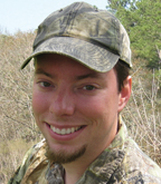
Colin Williams

Colin also spent a good deal of time mapping properties, and after high school, he decided to go to college to get into the field professionally. He has been doing it now for over sixteen years, and is well versed with the latest in GPS and GIS technologies. He's our mapping guru!
Colin has been an avid outdoor enthusiast since his youth. He brings his passion to his work. He has recently been working on developing maps with 3D modeling technologies. He recently killed his best buck to date, while navigating the ranch with one of the maps he produced for that property! Colin is married to his awesome wife, Barbara and they have two boisterous boys together.
Colin has been an avid outdoor enthusiast since his youth. He brings his passion to his work. He has recently been working on developing maps with 3D modeling technologies. He recently killed his best buck to date, while navigating the ranch with one of the maps he produced for that property! Colin is married to his awesome wife, Barbara and they have two boisterous boys together.
Thank you for taking the time to visit our website and learn more about what we do. We look forward to helping you with all your mapping needs.
For more information, contact: [email protected] or [email protected] or call 713-302-2028
Our maps are produced for personal or business use only and are not to be used for real estate property sales, tax records, real estate exchanges or donations.
For more information, contact: [email protected] or [email protected] or call 713-302-2028
Our maps are produced for personal or business use only and are not to be used for real estate property sales, tax records, real estate exchanges or donations.
